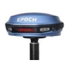
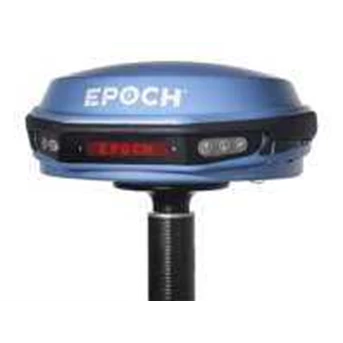
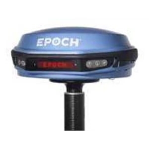
Detail GPS Geodetic EPOCH 35
Affordable GPS + GLONASS integrated receiver
Integrated Bluetooth® and Interface Control Panel
RTK real-time positions, static, and PPK
Network RTK positioning
Comprehensive Spectra Precision Survey Pro application software
Support for all GNSS data with Spectra Precision Survey Office software
The Spectra Precision® EPOCH® 35 GNSS system uses highly accurate Global Positioning System ( GPS) and GLONASS technology for cadastral, topographic, control, stakeout and other precision survey applications. Combining both these satellite services provides the user with the greatest possible satellite coverage. This allows observations in areas where only one satellite solution would not provide results. The EPOCH 35 is a complete GNSS system that includes a base, rover, field software, data collector, and radio modem. The EPOCH 35 GNSS receiver features integrated Bluetooth capability, and an internal, field replaceable battery. The rover includes an internal radio modem. The system runs Spectra Precision Survey Pro software. This premiere field software operates on the Spectra Precision Ranger™ , Nomad™ and Recon ® data collectors.
With fast, reliable initialization, the EPOCH 35 GNSS is a measurement solution that provides high-quality results in several survey modes including RTK, Static and PPK. The system operates without line-of sight between points, and can be used in any weather. Designed as a multi-purpose tool the EPOCH 35 GNSS system provides total flexibility. Built especially for surveyors, the compact and lightweight EPOCH 35 GNSS integrates the user control interface panel into one powerful measurement solution.
For RTK surveying, the base system may include a choice of radio modems that provide either a high or low power data link from the base to the rover. In addition, Network RTK is also supported by simply connecting to an external data capable cellular modem or by using a data collector with integrated WAN. Back at the office, surveyors can use the Spectra Precision Office software for post processing and quality control.
Positioning Data Link ( PDL) radio kits and communication products from Pacific Crest provide the critical connection between the GPS/ GNSS reference station and other GPS/ GNSS user equipment. Pacific Crest PDL units are compact, lightweight and power-efficient. The unique design of these units allows them to be mounted easily on all standard tripods and range poles.
Pacific Crest PDL radios are turnkey solutions for RTK data links that easily integrate with most major GPS/ GNSS OEM equipment. The data link features a 19, 200 bps data rate and flexible transparent or packet-based protocol. Waterproof and all-weather operational, PDL modems, kits and accessories help you increase productivity in the field no matter where you are since they are compatible with GPS RTK equipment.
Tampilkan Lebih Banyak